During the last ice age, a lower sea level surrounded Japan allowing for a more connected landform. Many of the separate islands we know today, including Kyushu, Shikoko, and Honshu, formed one island. The area now called Beppu, located on the western edge of the Seto Inland Sea (SIS), would have been in the middle of a weaving fluvial, stream-based, landscape.
 |
| Location of Beppu during glaciation |
Instead of staying that way, the glaciers ablated (retreated) causing the sea levels to rise and flow through Chugoku and Shikoko mountain ranges. This flooded the river basin forming the body of water known as the SIS. Beppu now contains remnants of the fluvial landscape in the west and the newer coastal landscape in the east. Due to this positioning, both fluvial processes and processes in the littoral zone, a marine ecological area close to the shore, affect the present day landscape. (“Oceans and Seas”)
 |
| Notice the mountainous, fluvial backdrop with "v" shaped valleys and the coastal foreground of Beppu |
Beppu 10 Years From Now:
Beppu hustles and bustles as an industrial and shipping powerhouse on the southwestern edge of the Seto Inland Sea ("Welcome"). As such, the more manmade than natural coastline was built to withstand differing tides, currents, sea levels, deposits, and erosion within a ten-year span. Revetments, jetties and groins control the few beaches that exist.
The biggest changes in ten years will come from the rivers flowing from the volcanic mountain ranges bordering Beppu on three sides. The perennial rivers will continue meandering through the valleys creating point bars and cut banks increasing the wiggle. However, even these, the biggest, changes will hardly be seen because the transport-limited area has dense foliage preventing quick water-based erosion.
 |
| The concrete pile to the left forms a revetment in Beppu harbor. These are used to "re-cover" depleting beaches. |
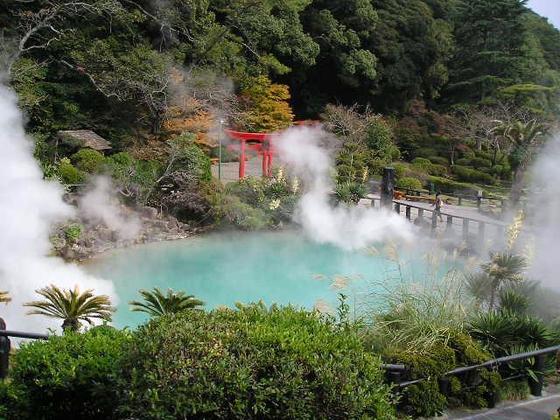 |
| Thick, transport limiting foliage surrounding one of Beppu's hot springs |
Beppu 100 Years From Now:
The appearance of fluvial processes will more prominently show after one hundred years. The streams’ striving to reach equilibrium will have changed the mountains, interfluves, and valleys in their favor for higher efficiency. The valleys will slowly erode ever wider, but still stay “v” shaped because they are created by rivers instead of glaciers.
 |
| Yuru Gorge showing erosion |
The gradient of the valleys may turn gentler as the foliage wears away with the water, but this amount of time will probably not show this effect. The buildings and roads on the coastline will have to be moved farther inland because the movement of sand and other particles follows the littoral drift northward. This process takes from the coast of Beppu and places that material up the coast in spite of the jetties.

Beppu 1000 Years from Now:
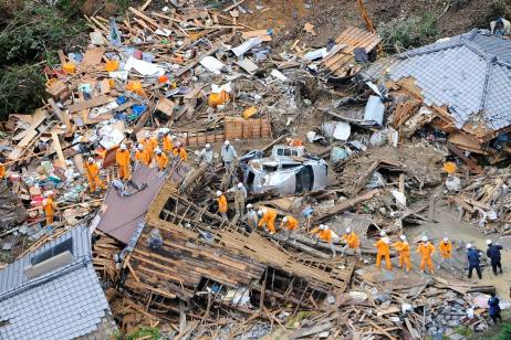
Beppu lies atop several fault zones and volcanic activity, which may not affect the area in the ten or one hundred years, but is sure to change the landscape in one thousand years (Eckelmann). Tectonic plate movement may uplift, submerge, or consume the entire bay area independent of the uplifting convergence of the rest of Japan.
 |
| Colored lines designate earthquake and fault zones |
Since this is difficult to predict, fluvial and coastal processes provide the most reliable outlook on Beppu. The processes seen after one hundred years will exacerbate to the point that Beppu will have to move up the coast or closer to the mountains to survive economically. All of this sounds dramatic, but in reality, the predictable “drastic” effects of the processes should stay relatively gentle because of the transport limitations and the gentle nature of the bay’s tides and waves.
 |
| The river cut hills covered in foliage leading out into Beppu Bay |
References:
Allen, Casey. “Fluvial Landscapes.” http://clasfaculty.ucdenver.edu/callen/1202/Landscapes/Fluvial/Fluvial.html
Allen, Casey. “Karst and Coastal Landscapes.” http://clasfaculty.ucdenver.edu/callen/1202/Landscapes/KarCoast/KarCoast.html
Eckelmann, Alena. http://www.japantoday.com/category/travel/view/exploring-kyushu%E2%80%99s-tectonic-nether-regions
“Oceans and Seas.” http://oceans.animalcorner.co.uk/pasea_seto.html
"Welcome to Beppu." http://www.beppu-navi.jp/nve-com/modules/aboutbeppu/
-http://www.globeimages.net/img-beppu-bay-oita-japan-5203.htm
--http://www.flickr.com/photos/wiwillbe/4276555653/sizes/l/in/photostream/
--http://www.flickr.com/photos/wiwillbe/4276555653/sizes/l/in/photostream/
-maps.google.com
- http://sv.wikipedia.org/wiki/Fil:Beppu_Bay.jpg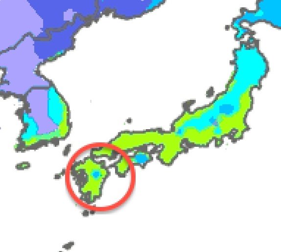


